
|
|
 Vegetated
fencerows, farm lanes, field borders, roadsides, ditch banks, shelter belts, and other linear features of the rural
landscape can provide key
habitat for many species of
wildlife. These strip-type covers often lie next to large nesting and feeding areas, they provide
edge habitat, and they give wildlife secure travel lanes between unconnected habitats.
Pheasants and rabbits escape into the thickets that often grow there.
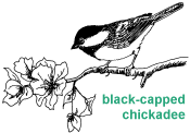
Wild turkeys, ruffed
grouse, cardinals, and chickadees regularly feed on the fruits and seeds found along fencerows. Vegetated
fencerows, farm lanes, field borders, roadsides, ditch banks, shelter belts, and other linear features of the rural
landscape can provide key
habitat for many species of
wildlife. These strip-type covers often lie next to large nesting and feeding areas, they provide
edge habitat, and they give wildlife secure travel lanes between unconnected habitats.
Pheasants and rabbits escape into the thickets that often grow there.
Wild turkeys, ruffed
grouse, cardinals, and chickadees regularly feed on the fruits and seeds found along fencerows.
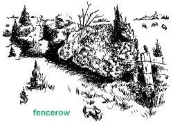
Naturalized field margins are species-rich sanctuaries for worms and other invertebrates and are important for the conservation of overall species diversity in croplands. Tree corridors improve habitat for birds, both as breeding territories and as feeding zones for migrants and residents. Corridors also serve as environmental filters, windbreaks, and streambank stabilizers. When snow is driven by west winds, fencerows and buffer stips that are oriented north and south keep snow on the land and out of ditches. Gradual melting of accumulated snow later prevents soil from drying out as quickly. Fencerows and shelterbelts may also protect houses and farm buildings from harsh weather conditions, decreasing energy needed to heat in winter and cool in summer. If you have such field borders and corridors on your property, consider enhancing them for wildlife. As travel lanes, the best fencerows are at least 30 to 50 feet wide and contain a mix of fruitbearing shrubs, conifers, and ground covers such as goldenrod, and aster along with weeds such as foxtail, ragweed, and smartweed. Other corridors may include sumac stands, piles of brush, and other micro-habitats of woody vegetation such as grapevines, blackberry, and dogwood. Wider is usually better, but any corridor is better than none at all. Selective cutting, prescribed burning, and planting of low-growing trees, highbush cranberry, silky and gray dogwood, nannyberry, crabapples and other shrubs can rejuvenate fencerows. These and other plants can be puchased through your county Conservation District and local nurseries. FencerowsIn heavily farmed areas of Michigan, such as the thumb region, fencerows offer one of the last traces of wildlife habitat. Clear farming practices have removed fencerows or reduced their width and eliminated their weedy and shrubby vegetation. Many people do not realize how important fencerows are to wildlife. Result show that 12
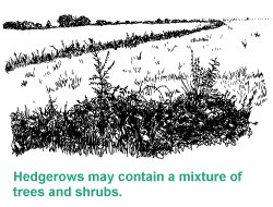
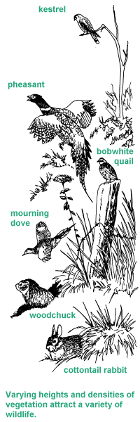
Vegetated fencerows that are 30 feet or wider lessen the impact of predation, especially on ground-nesting birds, and increase the opportunity for habitat diversity. Selective mowing, cutting and burning can increase the habitat mosaic, giving wildlife varying heights and densities of vegetation, especially grass. On the other hand, protecting the fencerow from grazing or burning encourages development of shrubs. Piling rocks and stones from adjacent fields along the fencerow gives reptiles and small mammals a place to hide. Planting or preserving trees provides opportunities for birds to nest and to rest. They also give hawks and owls perches. The management practices you employ will either encourage or discourage certain wildlife species, and that is why the wise landowner has an overall management plan. Hedgerows
If hedgerows do not already exist on your property, create them by planting shrubs or a shrub-conifer mixture. Consider locating the hedgerows across big, open fields, along present fencerows, in gullies, along streams, and around ponds, springs, food patches, nesting and breeding grounds, and other well-used wildlife sites. After site preparation, plant shrubs eight to ten feet apart. Plant evergreens (conifers) at the rate of one per every eight to twelve feet. Shrub rows should be spaced eight feet apart and conifer rows 10 feet apart to provide contiguous cover in eight to 12 years. A hedgerow with one row of conifers and two of fruitbearing shrubs will provide a strip that is 20 to 25 feet wide. Plan on thinning the conifers at 10 to 15 years of age. For hedgerows containing shrubs only, at least four rows spaced eight to ten feet apart should be planted in early spring and weed control should be used for the first three years. Control the weeds manually or with a selective herbicide or use mulches or clippings. Protect from fire and grazing. Some of the most effective hedgerows are those planted on south-facing slopes. For a second choice consider east- or west-facing slopes. On level ditch banks, planting the north and west edges will be most effective. If your plan is to divide a large field, exposure to the southeast works best. On slopes exceeding four percent, separate hedgerow and row crops with a six-foot wide border of sod. When planted across a natural waterway, space the shrubs and trees wide enough to allow a vigorous understory of grass and forbs to develop. RoadsidesRoadsides offer one of the best opportunities for habitat management because at least 40 species of wildlife use the associated grasslands. Species include pheasants, quail, mallards, goldfinches, meadowlarks, mourning doves, cottontails, and woodchucks. Although the acreage of roadside along a mile of road may seem small, collectively the figure in Michigan is at least several hundred thousand acres. Unfortunately, such habitat becomes a death trap for many nesting birds and mammals since most landowners mow or spray their roadsides throughout the nesting season. The key is to curtail mowing, at least until July 15 when birds have had a chance to complete nesting and brood rearing broods. When weed control is necessary, use spot mowing or spot spraying. To improve visibility for drivers, highway shoulders should be mowed 12 feet wide or not past the ditch. After July 15, clipping the grass to a height of 10 or 12 inches will leave nesting cover for the following spring. To establish grasslands along roadsides, consider planting a mixture of native warm season grasses (little bluestem, big bluestem, switchgrass, Indiangrass) or a cool season grass mixture (timothy, orchardgrass).
|
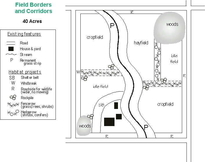
| The linked map is an example that demonstrates the many management options discussed throughout this chapter. The option(s) you choose should depend not only on your goals, but the location, condition, and present use of your land. |
|
 different bird species use herbaceous fencerows. When the fencerows contained scattered trees and shrubs, the number of bird species increased to 38. Those planted to continuous trees and shrubs attracted 48 species. Similarly, Michigan researchers found the density and diversity of bird nests increased as the number of fencerow shrubs increased because the shrubs added habitat variety through layers of
 Shelterbelts
