Bedrock Communities
Contributors
Michigan Department of Natural Resources
Michigan Natural Features Inventory
Michigan Nature Association
U.S. Geological Survey, Michigan Fish and Wildlife Cooperative Research Unit
Recommended Citation: Joshua G. Cohen, D. L. Cuthrell, P. J. Badra, A. Kortenhoven, and A. K. Henehan. 2026. Michigan’s Wildlife Action Plan: 2025-2035, Bedrock Communities. Michigan Department of Natural Resources, Lansing, MI.
What are bedrock communities?
Michigan is characterized by a unique geological history. Our landscape was shaped by glaciers that carved distinct landforms across Michigan over 10,000 years ago. Where the soil is shallow or missing entirely, exposed bedrock creates rare ecosystems known as bedrock communities. These natural communities are uncommon because they only occur in specific locations. This limited range makes them especially vulnerable to environmental changes. The exposed rock in these communities is typically one of four main types: limestone, sandstone, granite, or volcanic rock.
Types of bedrock communities
Limestones
Limestone bedrock ecosystems are mostly found in the eastern Upper Peninsula, along the ancient Niagara Escarpment: a rock ridge that stretches in an arc from Niagara Falls through Michigan to Wisconsin’s Door Peninsula. You can also find smaller limestone outcrops in the northeastern Lower Peninsula and on several Lake Huron and Lake Michigan islands.
These limestone rocks formed around 200 million years ago from the remains of ancient coral reefs in shallow seas that once covered the region. Today, they support six distinct natural communities, including inland types like alvar, limestone glades, and cliffs, as well as shoreline types like limestone cobble shore, limestone bedrock lakeshore, and limestone lakeshore cliff (Cohen et al. 2015, Cohen et al. 2025).
Many of these are rare or even critically imperiled in Michigan. Alvars and limestone lakeshore cliffs are especially at risk. Limestone natural communities support a unique flora that thrives in alkaline (high pH) soils and often includes a surprising mix of prairie and boreal (northern forest) plants growing side by side. Rare orchids, ferns, and other unusual plants are found here, including some that are more typical of distant prairie habitats.
Sandstones
Sandstone bedrock ecosystems are mainly found near the shores of Lake Superior, from the Michigan-Wisconsin border to Pictured Rocks National Lakeshore near Munising. In the Lower Peninsula, local exposures occur at Pointe Aux Barques on southern Lake Huron and one area along the Grand River near Grand Ledge. These sandstones were deposited around 500 million years ago.
Today, five types of natural communities form where this sandstone is exposed: sandstone bedrock glade and sandstone cliff in inland settings, and sandstone cobble shore, sandstone bedrock lakeshore, and sandstone lakeshore cliff along the Great Lakes shoreline. Like limestone communities, these are rare or critically imperiled with sandstone bedrock glades being critically imperiled.
Granites
"Granite" in Michigan refers to a mix of very hard rocks like granite, gneiss, schist, and quartzite, formed deep underground anywhere from 600 million to over 3 billion years ago during the Precambrian Era. In Michigan, these granite bedrock communities are found in the central Upper Peninsula, especially in the rugged Michigamme Highlands.
There are four main granite bedrock community types: granite glades and granite cliffs found inland, and granite bedrock lakeshores and granite lakeshore cliffs along Lake Superior. These ecosystems are rare, and some, like the granite lakeshore cliff, are critically imperiled.
Volcanics
The Keweenaw Peninsula and Isle Royale feature some of Michigan’s oldest and largest rock formations. These volcanic bedrock ecosystems formed over a billion years ago during a time of intense volcanic activity. Lava flowed from deep cracks in the Earth’s crust, creating thick layers of basalt which locally features sandstone and conglomerate intrusions. The subsequent Lake Superior Syncline formation created the basin for most of Lake Superior (Dorr and Eschman 1970, Schaetzl et al. 2009).
Today, volcanic rock ecosystems are found along the edges of this ancient basin. Six community types are found here: inland volcanic glades, northern balds, and cliffs, along with shoreline cobble shores, bedrock lakeshores, and lakeshore cliffs. Many are rare or critically imperiled, especially northern balds and volcanic lakeshore cliffs.
These places support plant life more commonly found in arctic or high-mountain environments rather than what one would expect in Michigan. The cool, foggy summers of Isle Royale and the Keweenaw Peninsula create ideal conditions for arctic-alpine disjuncts.
Why are bedrock communities important?
Bedrock communities offer unique opportunities to view, study and experience fundamental earth systems and processes that have shaped Michigan’s landscape, such as plate tectonics, rock and soil formation and deposition, glacial activity, ecological community change and the evolution of life itself (Geological Society of America 2022). They are among Michigan’s rarest communities and host unique species and communities of plants and animals often found nowhere else in the state (Cohen et al. 2020). In addition to their ecological and biodiversity value, our intact bedrock communities are emblematic of Michigan’s geological heritage, providing residents recreational, educational, cultural and economic benefits [AGH].
Natural communities found in Bedrock Communities | |
Alvar | Sandstone bedrock glade |
Granite bedrock glade | Sandstone bedrock lakeshore |
Granite bedrock lakeshore | Sandstone cliff |
Granite cliff | Sandstone cobble shore |
Granite lakeshore cliff | Sandstone lakeshore cliff |
Limestone bedrock glade | Volcanic bedrock glade |
Limestone bedrock lakeshore | Volcanic bedrock lakeshore |
Limestone cliff | Volcanic cliff |
Limestone cobble shore | Volcanic cobble shore |
Limestone lakeshore cliff | Volcanic lakeshore cliff |
Northern bald |
|
Helpful resources for identifying and understanding Michigan’s natural communities include Michigan Natural Features Inventory’s natural community classification (Cohen et al. 2015, Cohen et al. 2025) and natural community abstracts, both of which are available online along with photos, comprehensive descriptions, distribution maps, and thorough references from the scientific literature. MNFI’s most detailed bibliography on Michigan’s natural communities can be found in the publication “Distribution Maps of Michigan’s Natural Communities” (Albert et al. 2008), which is also available for viewing and downloading at the MNFI website.
Accomplishments
MNFI conducted surveys from 2015 through 2025 and documented 112 new occurrences of bedrock natural community types (MNFI 2025) with funding from US Fish and Wildlife Service (USFWS), US Environmental Protection Agency (EPA), Michigan Department of Natural Resources (DNR), Michigan Department of Environment, Great Lakes, and Energy (EGLE), Little Traverse Bay Bands of Odawa Indians, The Nature Conservancy (TNC), and Huron Pines.
Michigan Natural Features Inventory developed draft monitoring protocols for evaluating the ecological integrity of alvar (Cohen and Enander 2019).
With at least 22 nesting pairs reported in 2022, the Peregrine Falcon was reclassified from State Endangered to State Threatened in 2023 (Redig et al. 2022; Michigan DNR 2023).
The Tapered Vertigo was recorded in Michigan for the first time since 2015. The occurrence, a first for Mackinac County, was added to the state’s Natural Heritage Database (MNFI 2025).
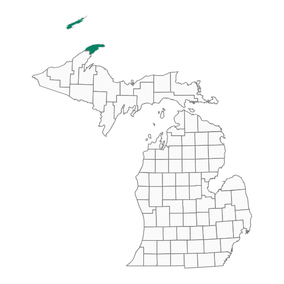
Focal species
Blunt-lobed Woodsia
Woodsia obtusa
State Threatened
Blunt-lobed woodsia is a medium-sized, lance-shaped fern found on moist and at least partially-shaded cliff systems (Palmer 2018). It has both sterile, evergreen fronds and fertile, deciduous fronds. The fern blade has twice-divided toothed leaves, petioles light brown, and spores borne in amoeba-like clusters on underside of pinnae. Within Michigan, it has been documented in association with limestone, granite and volcanic cliff systems. Populations in Michigan occur in the northernmost part of its range and are sporadic geographically. Blunt-lobed woodsia is more common in states south of Michigan (Reznicek et al. 2011). This species has been documented from seven sites in six counties in Michigan as of 2025 in the state's Natural Heritage Database and only one of these occurrences was observed within the last 40 years (1985-2025; MNFI 2025).
Goal
- Determine distribution and abundance and habitat quality across range.
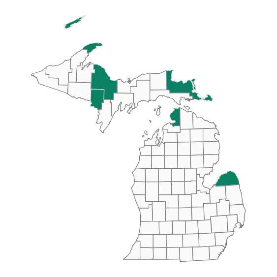
Large Marble
Euchloe ausonides
Special Concern
In Michigan, the Large Marble (1.5 to 2 inch wingspan) is known only from Isle Royale, where it is found in open areas, rock outcroppings, trails, and ridge tops. Like many butterflies, the females are slightly larger than males. The upper sides of the wings of this large butterfly are white with a black-patterned apex and a black, crescent-shaped mark along the leading edge of the forewing. The underside of the hindwing is marbled with greenish gray scales and antennae are checked with black. The caterpillar is striped with black, yellow, and white. Major food plants are crucifers, mainly rock cresses (e.g. Boechera stricta) (Nielsen 1999). Little is known about the species' status, distribution, life history, ecology and threats in Michigan. This species has been documented from only one site in one county in Michigan as of 2025 in the state's Natural Heritage Database and has not been observed within the last 20 years (2005-2025; MNFI 2025).
Goal
- Determine baseline distribution and abundance.
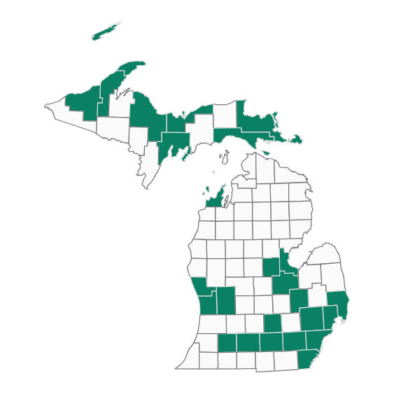
Peregrine Falcon
Falco peregrinus
State Threatened
The Peregrine Falcon is relatively large for a falcon, with a wingspan of 41 inches. Its body is stocky, with pointed wings and a short tail. The adult falcon has a slate gray back, white breast, finely barred underparts, black cap, white cheek patch, and distinctive dark, heavy “sideburns” (Monfils 2007). In Michigan, Peregrine Falcons historically nested on cliff faces located above the Great Lakes shoreline (Evers 1994). They have since been introduced in several Michigan cities and have adapted to nest in artificial structures such as buildings, bridges, and towers and feed on the abundance of small city birds like rock pigeons. Bedrock cliffs represent the species’ only naturally occurring nesting habitat. While having one of the most extensive global distributions, Peregrine Falcons were never abundant anywhere due to their specific nesting habitat requirements and position in the food web as top predators (Hess 1991). Peregrine Falcons were formerly extirpated throughout much of their original range due to exposure to chemicals such as DDT (White et al. 2002). Re-occupancy and restoration are still incomplete, although their numbers are increasing. This species has been documented from 43 sites in 26 counties in Michigan as of 2025 in the state's Natural Heritage Database and 33 of these occurrences were observed within the last 20 years (2005-2025; MNFI 2025).
Goal
- Continued increase in the number of pairs successfully producing young in Michigan.
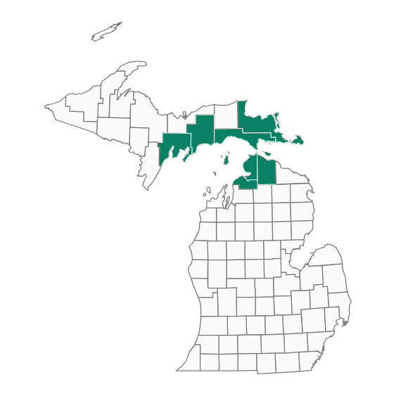
Tapered Vertigo
Vertigo elatior
Special Concern
The Tapered Vertigo is a minute land snail with a translucent, chestnut, brown-colored shell that is less than one tenth of one inch (0.087 inches) in height. It has a cylindrical beehive shape with five whorls (Lee 2007). In Michigan, the Tapered Vertigo has been found in a variety of open calcareous sites including natural communities such as fens, limestone cobble shore, alvar, limestone bedrock glade and conifer swamps dominated by Northern White-cedar or Tamarack, namely, rich conifer swamp and rich tamarack swamp (Nekola 1998). Due to the Tapered Vertigo’s limited range in Michigan and vulnerability to threats, all known populations of this species should be protected and monitored. This species has been documented from 28 sites in seven counties in Michigan as of 2025 in the state's Natural Heritage Database and 12 of these occurrences were observed within the last 20 years (2005-2025; MNFI 2025).
Goals
- Determine baseline distribution and abundance.
Assess and monitor bedrock communities
Bedrock communities are uniquely adapted to rapid fluctuations between wet and dry conditions, suggesting a potential resilience to a changing climate (Cohen et al. 2020). However, bedrock communities are rare within Michigan because their distribution is limited to localized exposures of bedrock. Because of this restricted geographic distribution, these communities are likely vulnerable because they have limited opportunities for range expansion. To effectively conserve and manage these systems, further research is needed to understand their sensitivity, adaptive capacity and long-term ecological dynamics under changing environmental conditions.
Call Out Box: Bedrock Communities on Public Lands
Known bedrock communities located upon state and federal public lands are generally identified and protected within management systems and provide continuity of habitat for associated focal species. For example, all known bedrock communities on state forest land are protected as high conservation value Ecological Reference Areas and one of the highest concentration of bedrock communities in Michigan is the federally designated wilderness on Isle Royale.
Focal species adaptive capacity
Adaptive capacity is a species’ ability to tolerate or adapt to environmental change, whether that be through shifting in space or persisting in place (Thurman et al. 2020). Michigan Natural Features Inventory, with funding support from the Michigan Department of Natural Resources, assessed Adaptive Capacity for over 500 Midwest SGCN from 2023-2024 (Appendix 3). We chose to increase clarity at expense of precision in technical language used by Thurman et al. (2020) in their paper. The Michigan Department of Natural Resources created broad management strategies based off assessment results and are intended to be stepped down based on management scale, capacity and resources. Management strategies for assessed 2025-2035 focal species are:
Lowest Adaptive Capacity | Strategy | |
Peregrine Falcon | Population Size | Increase habitat connectivity |
Vertigo snails | Population Size | Increase habitat connectivity |
Large Marble | Dependent on Other Species | Enhance reproduction or survival |
Threats and conservation actions to habitat
Threats
Natural System Modifications
- Habitat loss due to mineral extraction and the expansion of mines and quarries (especially in limestone communities).
Invasive & Other Problematic Species, Genes & Diseases
- Ungulate herbivory reduces the floristic diversity of bedrock communities. This is especially prevalent on Drummond Island in limestone systems impacted by white-tailed deer and on Isle Royale in volcanic communities impacted by moose.
- Invasive plant species can become locally problematic in bedrock communities especially following disturbance such as erosion from off-road vehicles and wildfire (Cohen et al. 2020).
- New and existing roads and trails can degrade natural communities and provide routes for invasive plants to establish.
Human Intrusions & Disturbance
- Bedrock communities are especially susceptible to erosion from off-road vehicles and concentrated foot traffic due to their shallow soils and flat topography (especially with limestone / dolostone substrates; Albert 2007).
- The vegetation of bedrock communities can be extremely slow to recover or reestablish following excessive disturbance due to thin soils and shallow roots.
- Use of escarpments for rock climbing has the potential to degrade vegetation along the cliff edge and face (Cohen et al. 2020).
Conservation Actions
Land and Water Management
- Maintain a buffer of natural communities surrounding bedrock ecosystems to prevent desiccation and limit the local seed source for invasive species distributed by wind or birds.
- Reduce large ungulate populations on islands supporting bedrock ecosystems to reduce browse pressure. (Wilton 2021)
- Control invasive species infestations with special concern for avoiding damage to rare species populations. [IMPM] [TIS]
Law & Policy
- Prohibit off-road vehicle activity in alvar and limestone bedrock glade. Increase literacy in ORV community about rarity and ecosystem services of bedrock communities.
- Take appropriate enforcement actions for violations of the Michigan Threatened and Endangered Species Act (NREPA Part 365), the Invasive Species Order (NREPA Part 413) and maintain the Prohibited and Restricted Species list pursuant to the Natural Resources and Environmental Protection Act, P.A. 451 of 1994, as amended.
Conservation Designation and Planning
- Avoid construction of trails and roads through-, and reroute existing trails and roads away from-, bedrock communities.
- Conservation efforts should focus on preserving the ecological integrity of existing high-quality bedrock communities, because thin soils and slow-growing lichen and moss cover are sensitive to anthropogenic disturbance and recover slowly. [ISRO]
Research and Monitoring
- Study the fire history of bedrock ecosystems through dendrochronological research to determine appropriate fire return intervals. Prescribed fire should be evaluated for implementation in appropriate landscapes and bedrock systems. [SFMP] [SFAP]
- Research impacts of herbivory on rare species and their habitats. (Wilton 2021) House in a centralized database.
- Conduct further surveys to evaluate the distribution and composition of the newly discovered and described sandstone bedrock glade.
- Conduct further surveys to get baseline information on rare flora and fauna as well as non-vascular composition.
Threats and conservation actions for focal species
Blunt-lobed woodsia
Threats
Lack of Knowledge
- Undocumented populations of this overlooked, often misidentified, and cryptic fern may exist in Michigan.
Natural System Modifications
- Creation of large, excessively open areas (e.g., clearcutting, forest disturbance) that are subsequently colonized by competing species could lead to the decline of the Blunt-lobed Woodsia (Environment Canada 2012).
Residential & Commercial Development
- Residential and commercial development could lead to habitat destruction or degradation and destroy or further isolate populations (NatureServe 2025).
Human Intrusions & Disturbance
- Pedestrian traffic could disturb or eliminate substrate on fragile slopes on which the species grows (Environment Canada 2012).
Invasive & Problematic Species, Pathogens & Genes
- Invasive species like Common Buckthorn may outcompete the Blunt-lobed Woodsia (NatureServe 2025, Environment Canada 2012).
Changing Weather Patterns
- Increasing temperatures and droughts may reduce suitable habitat.
Conservation Actions
Species Management
- Every 5 years or less, monitor all known populations. [BLW]
Conservation Designation & Planning
- Develop habitat management plans for known populations to maintain the species’ viability in Michigan. [BLW]
Research & Monitoring
- Survey likely habitat for undocumented populations. [BLW]
- Conduct population genetic and adaptation analyses relative to populations outside of Michigan.
- Survey cliffs and boulders in late summer and fall to locate cryptic populations that are mistaken for other fern species. [BLW]
- Document habitat conditions.
- Understand population genetic and adaptation relative to main range in southern USA.
Large marble
Threats
Lack of Knowledge
- Unknown status, abundance and distribution in Michigan.
- Unknown life history details and ecology.
- Unknown impacts of individual and combined threats.
Conservation Actions
Land & Water Management
- Maintain sufficient densities of the species' host plants in occupied areas. [RPMB]
- Manage and protect known sites. [PBMP]
Conservation Designation & Planning
- Development habitat management plans for known occupied areas. [PBMP] [PRAP]
Research & Monitoring
- Conduct surveys to determine the current status, abundance and distribution in Michigan, especially in the western Upper Peninsula region (e.g., Porcupine Mountains and Keweenaw Peninsula).
- Assess impacts of suspected threats. [RPMB]
Peregrine falcon
Threats
Human Intrusions & Disturbance
- Loss or modification of nesting sites, which are limited in number (White et al. 2002).
- Loss of urban-dwelling peregrine falcons due to collisions with buildings/windows, vehicles, wires, or other objects and when nestlings fall from nesting areas or are killed by machinery (Hager 2009).
Conservation Actions
Land & Water Management
- Protect nesting sites from physical alteration and excessive human disturbance. Protect associated habitats, such as nearby wetlands and forests, which provide important prey items. [PF]
Law & Policy
- The continued ban of organochlorine pesticides, such as DDT, dieldrin and aldrin is critical to the continued improvement in the status of peregrine falcon. Other contaminants, such as PCBs, mercury and lead can also have negative effects (Cade et al. 1968, Hickey and Anderson 1968, Peakall 1970, Peakall 1974, White et al. 2002). [RECP] [RECH]
Research & Monitoring
- Systematic surveys of current and historic nesting areas to monitor the status of the species in Michigan. [MPPF]
- Monitoring to evaluate potential changes to habitat and level of human disturbance for the protection of important nesting sites
Tapered vertigo
Threats
Lack of knowledge
- Undocumented populations of this overlooked and cryptic species may exist in Michigan.
- Specific habitat requirements, life history and ecology in Michigan are not well known.
Human Intrusions & Disturbance
- Sensitive to excessive trampling and ORV use (Rosenthal et al. 2022).
- Sensitive to burning and fire management (Nekola 2002).
Natural System Modifications
- Sensitive to changes in temperature and water availability within their microhabitats through loss of shade from canopy cover and hydrological alterations.
Conservation Actions
Land & Water Management
- Buffer from management and recreational activities (Nekola 1998) such as rock climbing (McMillan et al. 2003).
- Avoid hydrological alterations that would affect known populations (Lee 2007).
- Avoid land-use activities that alter critical habitat requirements, including suitable microclimate, soil surface architecture and adequate moisture, calcium, food and refuge in occupied areas (Lee 2007).
- Avoid use of prescribed fire in occupied sites. If prescribed fire is implemented establish refugia and burn at intervals of at least 15 years (Nekola 1998, Nekola 2002).
Conservation Designation & Planning
- Develop habitat management plans for documented populations.
- Protect alvars, fens, conifer swamps and tamarack-sedge wetlands with potential habitat (Nekola 1998).
Research & Monitoring
- Survey for undocumented populations in likely habitat to more accurately determine status and range in Michigan.
- Assess population trends and viability of documented populations.
- Describe and categorize species needs including specific habitat requirements, life history and ecology in Michigan.
- Investigate effects of off-road vehicle use and other potential threats (Nekola 1998).
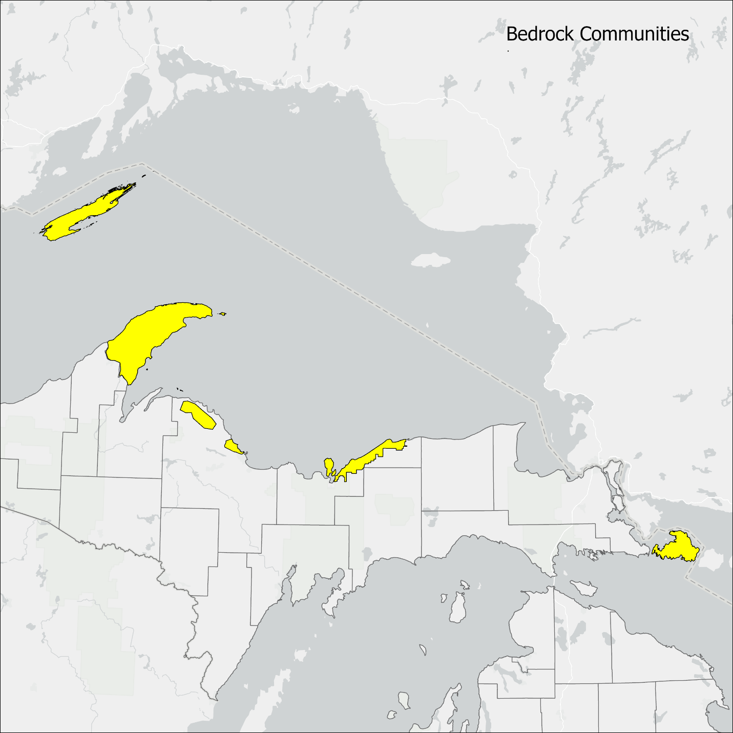
Places for partnership
This map was created in collaboration with partners and highlights focal areas to work in over the next 10 years. Creating shared goals helps focus efforts and build collaboration. While this map has a select few areas highlighted, conservation work benefiting any Bedrock Community is welcome and encouraged.
How will we monitor?
Bedrock Communities
- Continue to survey and update quality rankings for Bedrock Communities in the state’s Natural Heritage Database.
- Develop monitoring protocol for evaluating the ecological integrity of bedrock natural communities.
Focal Species
Blunt-lobed Woodsia
- Every 5 years or less, collect count-based and potentially density population measurements in a manner so that the data is interoperable with that collected by other states and agencies.
- Every 5 years or less, document any observable changes with the area occupied for a population.
- Update occurrences in the state’s Natural Heritage Database.
Large Marble
- Establish baseline population status and distribution with targeted, time-meander surveys.
- Update occurrences in the state’s Natural Heritage Database.
Peregrine Falcon
- Continue monitoring known nest sites.
- Use community science programs, like eBird, to help assess distribution, relative abundance and find new nest sites.
- Update occurrences in the state’s Natural Heritage Database.
Tapered Vertigo
- Continue standardized survey methodology to document distribution.
- Update occurrences in the state’s Natural Heritage Database.
How does this plan link with other conservation plans?
[BLW] Recovery Strategy for the Blunt-lobed Woodsia (Woodsia obtusa) in Ontario (Environment Canada 2012)
[IMPM] Great Lakes Invasive Plant Management Plan and Environmental Assessment (National Park Service 2011)
[ISRO] Isle Royale Wilderness Stewardship Plan and Draft Environmental Impact Statement (National Park Service 2023)
[MPPF] Monitoring Plan for the American Peregrine Falcon, A Species Recovered Under the Endangered Species Act (USFWS 2003)
[PBMP] Pollinator-friendly BMPs for Federal Lands (USFS 2015)
[PF] Featured Species Habitat Management Guidance for Peregrine Falcon (Michigan DNR 2023)
[PRAP] Pollinator Research Action Plan: Report of the Pollinator Health Tark Force (The White House 2015)
[RECP] Action Plan to Reduce Exposure of Vulnerable Federally Listed Endangered and Threatened Species from the Use of Conventional Pesticides (USEPA 2024a)
[RECH] Herbicide Strategy to Reduce Exposure of Federally Listed Endangered and Threatened Species and Designated Critical Habitats from the Use of Conventional Agricultural Herbicides (USEPA 2024b)
[RPMB] Draft Recovery Plan for Island Marble Butterfly (Euchloe ausonides insulanus) (USFWS 2022)
[SFAP] State Forest Action Plan (Michigan DNR 2020)
[SFMP] State Forest Management Plan (Michigan DNR 2024)
[TIS] Terrestrial Invasive Species Management Plan (State of Michigan 2024)
Literature Cited
Show all references
Albert, D.A. 2007. Natural community abstract for limestone bedrock glade. Michigan Natural Features Inventory, Lansing, MI. 7 pp.
Cade, T.J., C.M. White and J.R. Haugh. 1968. Peregrines and pesticides in Alaska. Condor 70:170-178.
Cohen, J.G. and H.D. Enander. 2019. Rare coastal ecosystem monitoring. Michigan Natural Features Inventory Report Number 2019-08, Lansing, MI. 60 pp.
Cohen, J.G., M.A. Kost, B.S. Slaughter, and D.A. Albert. 2015. A field guide to the natural communities of Michigan. Michigan State University Press, East Lansing, Michigan. 362 pp.
Cohen, J.G., M.A. Kost, B.S. Slaughter, D.A. Albert, J.M. Lincoln, A.P. Kortenhoven, C.M. Wilton, H.D. Enander, M.E. Anderson, M.R. Parr, T.J. Bassett, and K.M. Korroch. 2025. Michigan Natural Community Classification [web application]. Michigan Natural Features Inventory, Michigan State University Extension, Lansing, MI. Available at https://mnfi.anr.msu.edu/communities/classification.
Dorr, Jr. J.A. and D.F. Eschman. 1970. Geology of Michigan. The University of Michigan Press, Ann Arbor.
Environment Canada. 2012. Recovery Strategy for the Blunt-lobed Woodsia (Woodsia obtusa) in Canada. Species at Risk Act Recovery Strategy Series. Environment Canada, Ottawa. iv + 19 pp.
Evers, D.C. 1994. Endangered and Threatened Wildlife of Michigan. The University of Michigan Press, Ann Arbor. 412 pp.
Frest, T.J. 1990. Final report, field survey of Iowa spring fens, contract #65-2454. Final report to the Iowa Department of Natural Resources, Des Moines, IA.
Geological Society of America. 2022. GSA Position Statement: Geoheritage. Web. Available https://rock.geosociety.org/net/documents/gsa/positions/pos20_Geoheritage.pdf
Hager, S.B. 2009. Human-Related Threats to Urban Raptors. Journal of Raptor Research 43(3), 210-226. https://doi.org/10.3356/JRR-08-63.1
Hess, R.E. 1991. Species account for peregrine falcon (Falco peregrinus). Pages 535-536 in The Atlas of Breeding Birds in Michigan. Brewer, R., G. A. McPeek and R.J. Adams, Jr. (eds). 1991. Michigan State University Press, East Lansing, MI.
Hickey, J.J. and D.W. Anderson. 1968. Chlorinated hydrocarbons and eggshell changes in raptorial and fish-eating birds. Science 162:271-273.
Lee, Y. 2007. Special animal abstract for Vertigo elatior (tapered vertigo). Michigan Natural Features Inventory, Lansing, MI. 4 pp.
McMillan, M.A., J.C. Nekola and D.W. Larson. 2003. Effects of Rock Climbing on the Land Snail Community of the Niagara Escarpment in Southern Ontario, Canada. Conservation Biology 17: 616-621.
Michigan Department of Environmental Quality (MDEQ). 2008. Michigan Coastal and Estuarine Land Conservation Plan. Lansing, MI. 69 pp.
Michigan Department of Natural Resources (DNR). 2016. Featured Species Habitat Management Guidance for Peregrine Falcon. Wildlife Division. Lansing, MI. 2 pp.
Michigan Department of Natural Resources (DNR). 2023. Threatened and Endangered species list. Web. Accessed 3 November 2025. https://www.michigan.gov/dnr.
Michigan Natural Features Inventory (MNFI). 205. Michigan Natural Heritage Database. Lansing, MI.
Monfils, M.J. 2007. Special animal abstract for Falco peregrinus (peregrine falcon). Michigan Natural Features Inventory, Lansing, MI. 5 pp.
National Parks Service. 2023. Isle Royale Wilderness Stewardship Plan and Draft Environmental Impact Statement. Draft. Isle Royale National Park, U.S. Department of the Interior National Parks Service. https://parkplanning.nps.gov/ISROWilderness.
NatureServe. 2025. Woodsia obtusa. NatureServe Explorer. Available https://explorer.natureserve.org/
Nekola, J.C. 1998. Terrestrial gastropod inventory of the Niagaran Escarpment and Keweenaw volcanic belt in Michigan’s Upper Peninsula. Final report to the Natural Heritage Program, Michigan Department of Natural Resources, Lansing, Michigan. 133 pp.
Nekola, J.C. 2002. Effects of fire management on the richness and abundance of central North American grassland land snail faunas. Animal Biodiversity and Conservation 25.2: 53-66.
Nielsen, M.C. 1999. Michigan butterflies and skippers: A field guide and reference. MSU Extension, Michigan State University. East Lansing, MI. 248 pp.
Palmer, D.D. 2018. Michigan ferns and lycophytes: A guide to species of the Great Lakes Region. University of Michigan Press. Ann Arbor, MI. 381 pp.
Peakall, D.B. 1970. Pesticides and the reproduction of birds. Scientific American 222:73-78.
Peakall, D.B. 1974. DDE: its presence in peregrine eggs in 1948. Science 183:673-674.
Redig, P.T., J.S. Castrale and J.A. Goggin. 2007. Midwest peregrine falcon restoration, 2006 annual report. Midwest Peregrine Society. http://midwestperegrine.org
Redig, P.T., J.S. Castrale and A. Burnette. 2022. Midwest peregrine falcon restoration, 2022 report. Midwest Peregrine Society. http://midwestperegrine.org
Reznicek, A.A., E.G. Voss, and B.S. Walters. 2011. Michigan Flora Online. University of Michigan. Web. https://lsa-miflora1-p.lsait.lsa.umich.edu/#/record/2811
Rosenthal, J., R. Booth, N. Carolan, O. Clarke, J. Curnew, C. Hammond, J. Jenkins, E. McGee, B. Moody, J. Roman, K. Rossi, K. Schaefer, M. Stanley, E. Ward, and L. Weber. 2022. The Impact of Recreational Activities on Species at Risk in Canada. Journal of Outdoor Recreation and Tourism 40: 100567. https://doi.org/10.1016/j.jort.2022.100567.
Schaetzl, R., J. Darden, and D. Brandt. 2009. Michigan Geography and Geology. Pearson Custom Publishing. 672 pp.
Soulliere, G. J., M.A. Al-Saffar, K.R. VanBeek, C. M. Tonra, M.D. Nelson, D.N. Ewert, T. Will, W.E. Thogmartin, K. E. O’Brien, S.W. Kendrick, A.M. Gillet, J.R. Herkert, E.E. Gnass Giese, M.P. Ward, and S. Graff. 2020. Upper Mississippi / Great Lakes Joint Venture Landbird Habitat Conservation Strategy – 2020 Revision. U.S. Fish and Wildlife Service, Bloomington, Minnesota, USA.
State of Michigan. 2024. Terrestrial Invasive Species Management Plan, Lansing, MI. 46 pp.
Thurman, LL, B Stein, EA Beever, W Foden, SR Geange, N Green, JE Gross, DJ Lawrence, O LeDee, JD Olden, LM Thompson, and BE Young. 2020. Persist in place or shift in space? Evaluating the adaptive capacity of species to climate change. Frontiers in Ecology and Evolution 18(9): 520-528
White, C.M., N.J. Clum, T.J. Cade, and W.G. Hunt. 2002. Peregrine Falcon (Falco peregrinus). In The Birds of North America, No. 660 (A. Poole and F. Gill, eds.). The Birds of North America, Inc., Philadelphia, PA.
Wilton, C.M. 2021. White-tailed Deer (Odocoileus virginianus) Density and Habitat Use on the Beaver Island Archipelago Using a Camera Trap Array. Michigan Natural Features Inventory Report Number 2021-05, Lansing, MI
U.S Environmental Protection Agency (USEPA). 2024a. Action Plan to Reduce Exposure of Vulnerable Federally Listed Endangered and Threatened Species from the Use of Conventional Pesticides. Office of Pesticide Programs, Office of Chemical Safety and Pollution Prevention, Environmental Protection Agency, Washington, D.C. 39 pp.
U.S. Environmental Protection Agency (USEPA). 2024b. Herbicide Strategy to Reduce Exposure of Federally Listed Endangered and Threatened Species and Designated Critical Habitats from the Use of Conventional Agricultural Herbicides. U.S. Environmental Protection Agency, Office of Chemical Safety and Pollution Prevention, Office of Pesticide Programs, Washington, D.C. 79 pp
U.S. Fish and Wildlife Service (USFWS). 2003. Monitoring Plan for the American Peregrine Falcon, A Species Recovered Under the Endangered Species Act. U.S. Fish and Wildlife Service, Divisions of Endangered Species and Migratory Birds and State Programs, Pacific Region, Portland, OR. 53 pp.
U.S. Fish and Wildlife Service (USFWS). 2015. Pollinator-friendly BMPs for Federal Lands. USDA Forest Service. Milwaukee, WI.U.S. Fish and Wildlife Service (USFWS). 2022. Draft Recovery Plan for Island Marble Butterfly (Euchloe ausonides insulanus). Portland, Oregon. viii + 27 pages.